Home
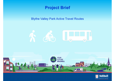
Blythe Valley Park - Active Travel Route
Active Travel Consultation 4th July 2022 - 5th August 2022
Blythe Valley Park - Active Travel Routes
As a Council we are looking at various ways in which we can help and support people to walk and cycle more across the borough. As part of the development of Blythe Valley Park, we secured developer contributions to fund active travel between the business park, Monkspath and Dorridge.
Driving less and walking and cycling more will help people to become healthy and at the same time it will improve air quality and reduce our carbon emissions. Walking and cycling is often called active travel because your activity levels increase when you move around the borough in this way.
In looking at the connection between Blythe Valley Park, Monkspath and Dorridge we are aiming to enhance opportunities for active travel by promoting safe and accessible routes for walking and cycling. An Active Travel Route promotes walking, cycling and access to public transport through higher-quality shared footpaths, safer junctions, and more direct routes. The core design principles embrace accessibility for all by making routes coherent, direct, safe, comfortable,-and attractive for all users.
A key focus is to connect these new routes to the existing walking and cycling network such as Wildlife Ways and the wider Local Cycle and Walking Infrastructure Plan proposals. This will contribute to the council's sustainability objectives and net-zero targets.
We are looking at five distinct Active Travel Routes which are detailed in the plans below. Phase 1 forms the central spine of these routes with various connections that could be implemented. These are subject to the availability of funding.
There are two proposals to connect Blythe Valley business park. The first connects the business park with Monkspath and the second connects the business park with Dorridge. These are detailed in the two separate presentations below.
Check out the following documents

Blythe Valley Park to Monkspath (Phases 1 - 4)
Phases 1-4 demonstrate how Blythe Valley Park will link into Monkspath with new Active Travel Routes using (A34) Stratford Road as the spine.
Phase 1
Proposals for Phase 1 are central to these proposals. The option to connect Blythe Valley to Monkspath includes widening the existing footway along the eastern section of the A34 Stratford Road to create a shared-use footpath from Huskisson Way to Monkspath Hall Road. To increase continuity and safety the addition of a toucan crossing and raised parallel crossing will be situated near the roundabout adjacent to Tesco. The relocation of bus lay-bys will open up further space at existing narrow sections. 
Phase 2
Phase 2 links into the Phase 1 proposals by providing a key link into Monkspath via Hay Lane. This proposal improves an existing connection by improving signage and road markings to introduce this corridor as a shared path for both cyclists and pedestrians.
Hay Lane will provide a link between the A34 Stratford Road and Monkspath Hall Road. This option provides for a new toucan crossing on Monkspath Hall Road (at the top end of Hay Lane) and will improve safety for families and cyclists who wish to use the proposed Active Travel Route. There is an option to utilise Hay Lane traversing along Monkspath Hall Road connecting to Frankholmes Drive / Monkspath Hall Road.
Phase 3
Proposals for Phase 3 connect from the A34 Stratford Road into Stanbrook Road traversing along Frankholmes Drive and connecting to the Wildlife Ways cycle routes along Monkspath Hall Road. The route will include improved signage and road markings to provide a shared path for both cyclists and pedestrians.
Phase 4
Proposals for Phase 4 continues the active travel route from phase 1 by widening the existing footway. To increase continuity and safety the addition of a parallel crossing adjacent to Costa Coffee will allow wider connections onto Dog Kennel Lane (towards Dickins Heath) and towards Shirley and the recently completed Tranche 2 routes along Cranmore Boulevard to Blossomfield Road. Please follow the link below to have your say on this proposed scheme from Blythe Valley Park to Monkspath Have Your Say Today - Blythe Valley Park - Active Travel Route - Solihull Active Travel (commonplace.is)
Blythe Valley Park to Dorridge Station (Phase 5)
Phase 5 presents 3 route options which connect Blythe Valley Park to Dorridge Station.
Route A provides the highest level of directness with the shortest distance from Blythe Valley Park to Dorridge Station at 4.23 kilometres. This is achieved by utilising Gate Lane as an Active Travel Route which vastly improves safety with less confident cyclists and families in mind. Gate Lane will need to be closed to general traffic except for access. We envisage a temporary trial of this closure to understand the impacts on wider vehicular traffic. There are various ways to connect the route from Gate Lane to Dorridge and the rail station, which were investigated as part of the consultation process.
Route B and C provide alternative options to connect to Dorridge. These routes are more difficult to implement than Route A and do not offer the same level of benefits for walking and cycling. Traffic calming and speed reduction measures are inevitable to make this safer as an Active Travel corridor. However, due to constraints in the existing width of the highway, cyclists will be expected to cycle on the carriageway with motorists.  Please follow the link below to have your say on these proposed options for Blythe Valley Park to Dorridge Station Have Your Say Today - Blythe Valley Park to Dorridge Station
Blythe Valley Park to Monkspath
Blythe Valley Park to Dorridge Station
This engagement phase has finished

...